
From the author, in their own words...


Scott Reinemann, Sinclair Community College
Transcript:
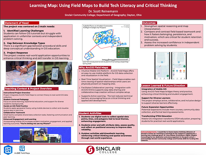
The idea behind this project came from a grant I received at Sinclair Community College focused on Learning Loss and reminded me of something I’ve noticed with students in my GIS class.
They can usually follow step-by-step tutorials well. However, when I give them a mapping prompt that’s a little different from what we practiced, they sometimes struggle with figuring out what to do next. There’s this gap between knowing the steps and actually being able to apply what they’ve learned.
I wanted to find a way to get students out of that “follow the directions” mindset and engage more critical thinking.
I therefore turned to something they use on a daily basis: their phone or mobile technology. I started using ArcGIS Field Maps on their phones and taking GIS into the real world. Instead of just working with data that’s already been created, students go outside, collect their own data around campus, and see that information shows up on a map in real time.
The project has them working alone or in small groups, collecting points, lines, and/or polygons, entering information about those features, and then having to think about things like, “Is this data accurate?” and “Does this make sense on the map?”
Honestly, my two favorite reactions from the students were, “You’re letting me use my phone?” and “I had no idea how many elevators we had on campus”
Those reactions really captured what I’m trying to do here. The technology becomes a way to get students engaged, but the real goal is the thinking that happens around it—spatial reasoning, problem-solving, teamwork, and building confidence in making decisions on their own.
So, ultimately, I’m trying to move students from “I know how to follow the GIS tutorial” to “I know how to figure out a GIS problem.”
Abstract:
The presentation will demonstrate a hands-on ArcGIS Field Maps class project to strengthen the link between geospatial theory and applied field practice. Integrating mobile GIS into the course helps students visualize spatial relationships in real time and collect and edit data collaboratively. This allowed students to engage in peer collaboration practices by introducing field-based, team-oriented projects where students can see tangible progress and feel ownership of their data. Working outdoors in a collaborative context encourages belonging, persistence, and problem-solving, which are all critical for student motivation and retention.
Key Words:
Tech Literacy, Critical Thinking, Active Learning
Outcomes:
1. Strengthen spatial reasoning and map interpretation.
2. Compare and contrast field-based teamwork and how it fosters belonging, persistence, and motivation, which are critical for student retention and success.
3. Assess the increased confidence in independent problem solving by students.
References:
Rossiter, K. M. (2022). Using ArcGIS Field Maps in the Classroom. Geography Teacher (Erie, Pa.), 19(4), 154–161. https://doi.org/10.1080/19338341.2022.2117719
Holloway, P., Kenna, T., Linehan, D., O’Connor, R., Bradley, H., O’Mahony, B., & Pinkham, R. (2021). Active learning using a smartphone app: analysing land use patterns in Cork City, Ireland. Journal of Geography in Higher Education, 45(1), 47–62. https://doi.org/10.1080/03098265.2020.1802703
Madsen, L., & Rump, C. (2012). Considerations of How to Study Learning Processes when Students use GIS as an Instrument for Developing Spatial Thinking Skills. Journal of Geography in Higher Education, 36(1), 97–116. https://doi.org/10.1080/03098265.2011.576336